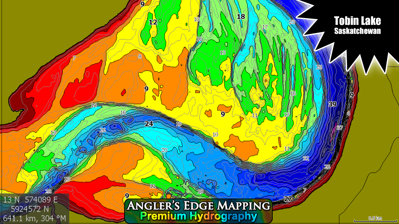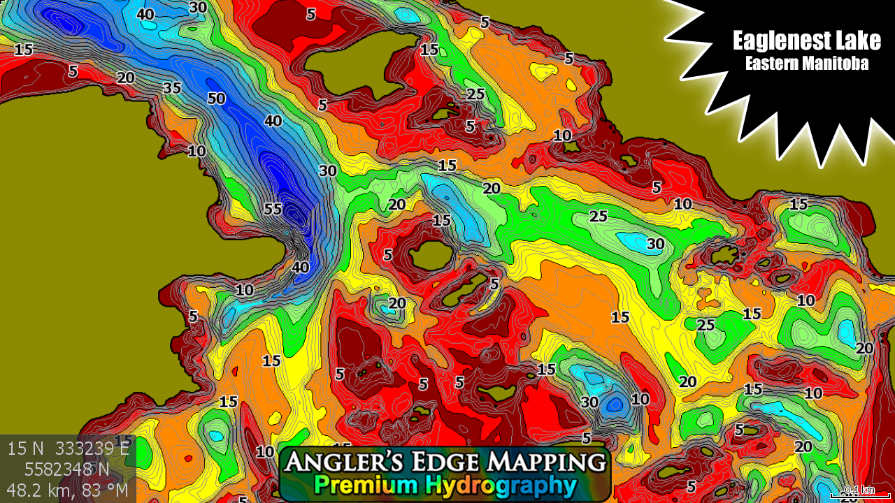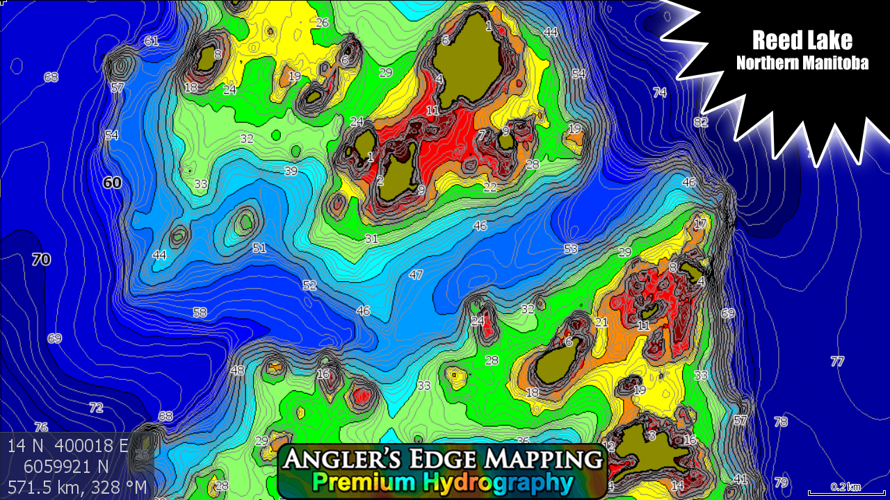
Digital Maps for Lowrance Sonars
Angler’s Edge Mapping (AEM) Digital Maps compatible with modern Lowrance (and Simrad) sonars allow you to view your favorite water bodies like never before, making your fishing trips more productive. Created from AEM exclusive survey data, carefully processed using modern equipment and techniques, these maps have set a new standard in Manitoba, Saskatchewan & Northwest Ontario. Angler’s Edge Mapping products feature:
- Detailed. Spot-on-the-spot quality mapping for entire lakes
- Accurate. True-to-life location & shape of structure, features & shorelines
- Easy to read. High-contrast color palette makes understanding lakes and rivers easy

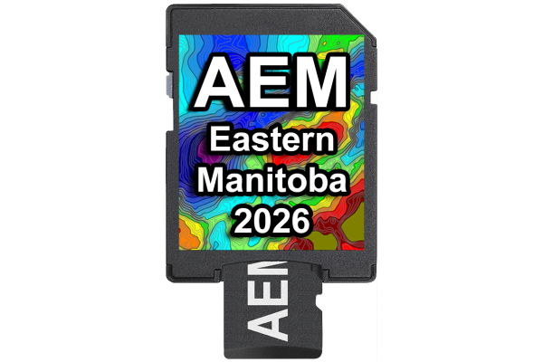
- Upgradeable. Customers can upgrade their chips for reasonable prices when new data is released.
- Exclusive coverage. The only maps available for many lakes in our catalog.
Click here to see our FAQ which contains information about compatible units.