
Why?
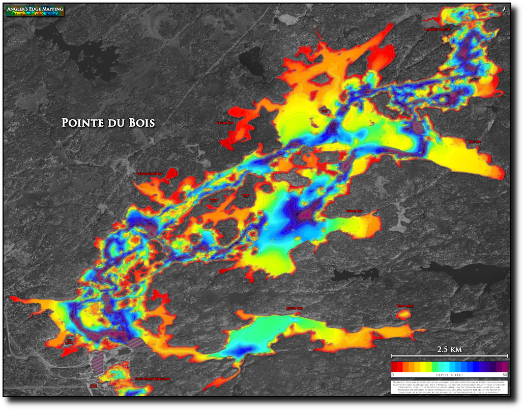
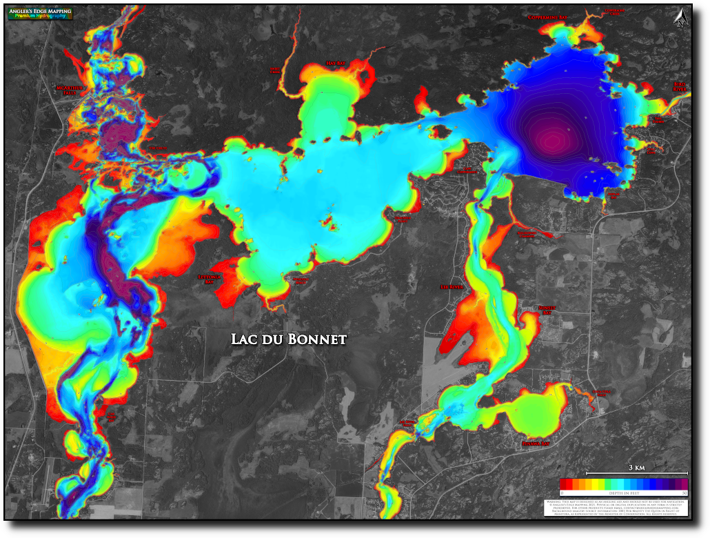
The AEM team has long had an obsession with maps, and several years ago we realized that the depth maps of Manitoba lakes available to anglers were of mediocre quality at best. Furthermore, traditional depth maps tend to be plain in appearance – hardly something a cottager would want on display on the living room wall. We strive to create maps that are a grade above the rest. Detailed. Accurate. Easy to read. Beautiful. Want a better map?
How?
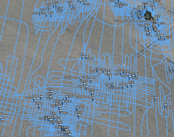
Creating each map is a multi-step process. Initially, we conduct intensive on-the-water surveys using high-end sonar/GPS technology. Even for a small lake, the surveying stage can take several days and many tanks of gas to complete to our high standards. Structure such as reefs, points, and saddles receive particular focus in order to capture the true shape, size, and nuances. Prop/skeg/hull damage are common; this abuse to our equipment is (unfortunately) necessary in order to thoroughly capture the details of shallow fish-holding structures that are so often critical to angling success. Following the on-the-water survey, the data is compiled and analyzed. Inconsistencies are filtered out using algorithms and manual inspection. At this point we generate a preliminary map for review. Often, the initial review reveals features requiring additional mapping detail, requiring us to revisit the spots in question. Once we are satisfied with the data, we generate final versions - Digital for your Lowrance chartplotter and mobile devices, as well as large-format prints for hanging in your cottage, office or home.
Copyright
All AEM maps are copyright of Angler's Edge Mapping Inc. Physical or digital duplication (except for personal backup) is strictly prohibited.
Our print maps make use of digital orthophotos. For Manitoba waterbodies, the background imagery source accreditation is as follows: 2001 Her Majesty the Queen in Right of Manitoba, as represented by the Minister of Conservation. All rights reserved. For Ontario waterbodies, the background imagery source accreditation is as follows: Geobase (Natural Resources Canada), reproduced in accordance with an open government Licence - Canada.
Photos used on our website are copyright of Angler's Edge Mapping Inc., or provided by Mike Smith (and used with permission). Thanks Mike!
Terms of Use
AEM products are designed as angling aids and should not be used for navigation. While Angler's Edge Mapping strives to produce maps that are as accurate as possible, slight imperfections undoubtedly exist; the maps are provided to the customer "as is" with respect to the mapped content. The end user is entirely responsible for the prudent use of Angler's Edge Mapping products. Angler's Edge Mapping will not be held liable for any direct, indirect, incidental, or exemplary damages or lost profits occurring while using our products.