Your Lake.
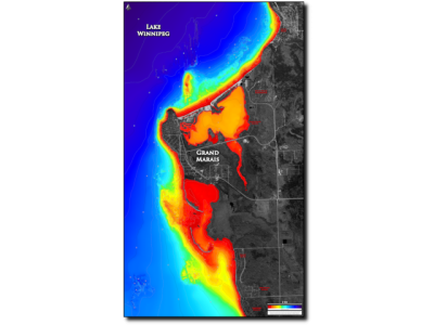
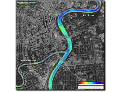
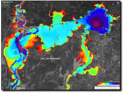
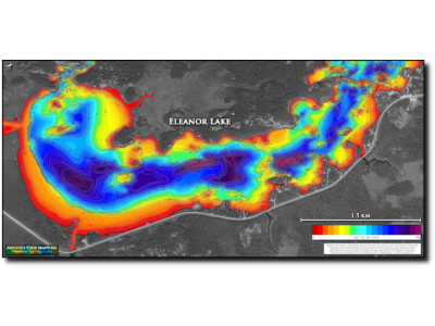
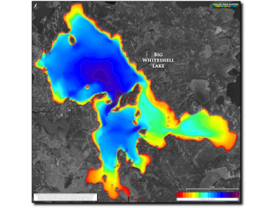
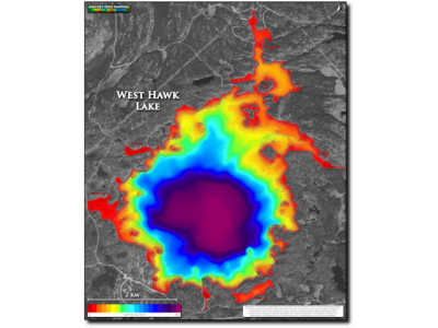
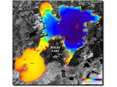
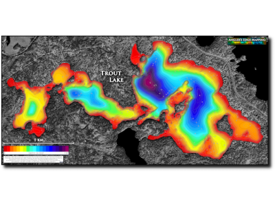
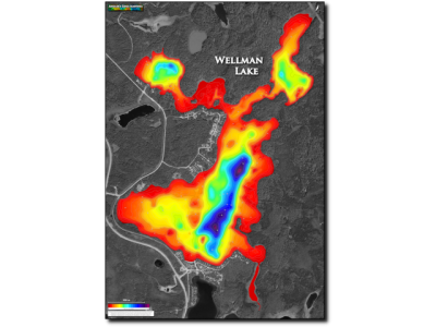
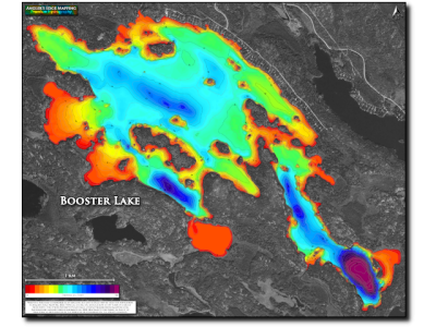
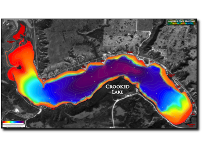
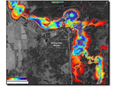
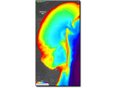
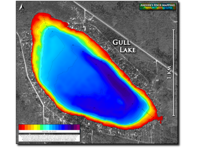
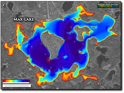
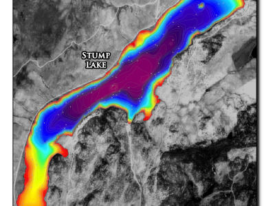
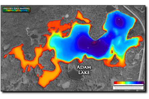
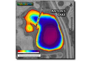
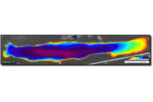
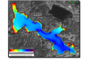
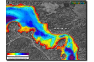
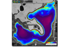
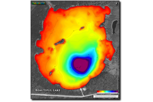
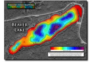
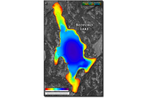
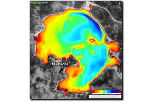
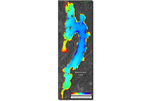
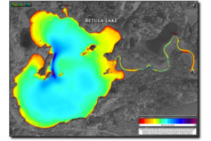
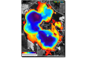
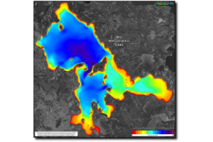
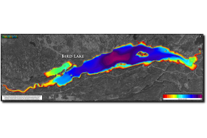
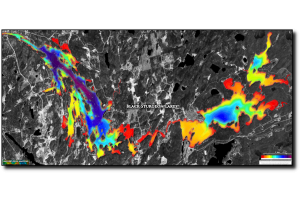
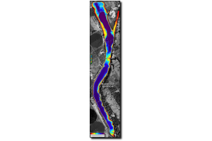
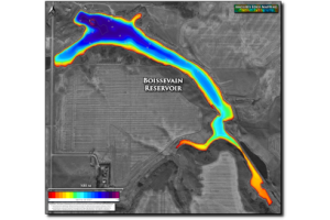
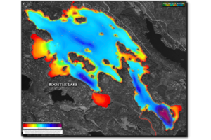
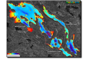
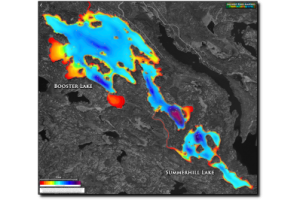
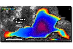
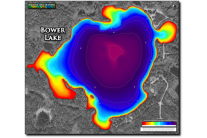
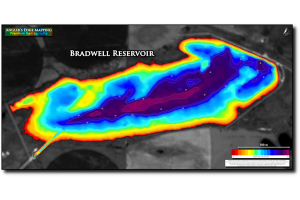
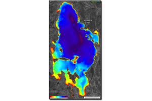
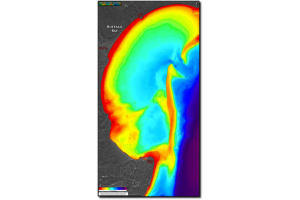
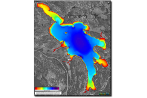
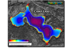
Stunning wall-art based on data collected during our meticulous on-the-water bathymetric (depth) surveys. Even for a small lake, the timeline for surveying is measured in days (weeks or even months for larger lakes)! After data collection and post-processing is complete, carefully selected colour gradients in combination with detailed contour lines are used to show depth variation and underwater structure such as reefs, points and humps for your favorite lakes and rivers. Greyscale aerial photographs provide the perfect back-drop.
The final products are:
- Large format
- High-resolution
- Professionally printed and mounted
All Your Lake print maps come with a 100% Satisfaction Guarantee. If you do not LOVE your map, simply return it within 7 days of receipt in new condition and we will issue a refund. We will even pay for return shipping!